Overview
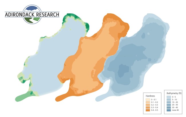
This data set contains interpolated lake characteristics data of twelve lakes, including depth, substrate hardness, and vegetation presence. These data can be useful for calculating the probability of occurrence of other biological organisms that have habitat preferences related to water depth and substrate. More information about the survey methodology is available here.
Citation, license, and contact information
For questions about this data set, contact Ezra Schwartzberg at Adirondack Research.
This data set is released under the Community Data License Agreement (permissive variant).
Data format
Annotations are provided in .csv format, with the following columns:
- Distance_from_shore (feet)
- Depth (feet)
- Bottom_Hardness (relative units)
- Vegetation (relative units, indicating vegetation height)
- Longitude
- Latitude
- Lake_Name
- County
- Township
- Date_surveyed
- AIS_Species (name of invasive species present, if any)
- AIS_Density (relative units)
Downloading the data
Data download links:
Download from GCP (155MB)
Download from AWS (155MB)
Download from Azure (155MB)
Having trouble downloading? Check out our FAQ.
Posted by Dan Morris.